


About GPS
General
GPS stands for Global Positioning System. The US military have placed a system of satellites in orbit that send out time signals and by monitoring the signals from a number of these it is possible, by applying some foul maths, to calculate where you are on the planet. Luckily there are lovely GPS units available that do all this for you. To get a decent fix on your location you need to be able to 'see' at least three of these satellites.
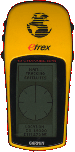
I have had a Garmin eTrex GPS system for a couple of years now and it has helped me find quite a few sites: the ones in the middle of bogs and such like with no real points of reference. For some unknown reason, until recently, I never recorded the exact locations of the sites I visit. However, I now endeavor to do so and I have started adding them to the site information displayed on the right hand side of pages. I will do this for new sites and for old ones when I revisit them.
Settings
I have been asked a couple of times recently what settings I use to get my GPS to display Grid References rather than Longitude and Latitude values. Obviously how you configure it will depend on the make and model of your device, but the names should be the same. I will describe the process for my eTrex:
- Go to the menu page (the one with "Setup" at the bottom) and select Setup.
- Select Units from the next menu. This should give you a screen with a list of odd settings.
- Set Position Format to Irish Grid.
- Set Map Datum to Ireland 1965.
- I set Units to METRIC and North Ref to MAGNETIC
My Readings
The readings I place on the page look like this:
S 12345 88822 (8m)
These are a ten figure grid reference that locate a spot to within 1m. Unfortunately, basic systems are not this accurate and the figure in the brackets shows the accuracy of the reading. This can be anything upto 25m out and no better than to within 5m.
At different type of site I take readings at different positions:
Tombs = At the 'entrance'
Stone Circles = In the centre
Churches and other buildings = At the entrance
Standing Stones, Crosses = Standing as close as I can
Rock Art, Bullauns = Standing as close as I can
Raths, forts = In the centre
Barrows, Cairns, Mounds = On top, in the middle if possible.
If you have a GPs unit yourself then by entering the value I give (not including the accuracy figure) you will be able to very close to the spot where I took the reading. The one thing to remember is if my system is 8m out and yours is 5m out then you could be 13m away from my location with the same reading. This doesn't really matter with tombs and such, but with rock-art panels it may be very important


Page loaded from cache: (Generation time: January 17 2020 14:45:15.)