


Glendalough : Visitor Centre
This site has subsites
| Glendalough (f) - Sevenchurches or Camaderry - Bullaun Stone | Glendalough Cathedral - Sevenchurches or Camaderry - Church |
| Glendalough Cross - Sevenchurches or Camaderry - High Cross | Glendalough Gateway - Sevenchurches or Camaderry - Miscellaneous Site |
| Glendasan River (Glendalough g) - Bullaun Stone | Glendasan River (Glendalough h) - Bullaun Stone |
| Glendasan River (Glendalough i) - Bullaun Stone | Glendasan River (Glendalough p) - Bullaun Stone |
| Miner's Village - Glendalough - Miscellaneous Site | Reefert Church - Church |
| Sevenchurches or Camaderry (Glendalough k) - Bullaun Stone | Sevenchurches or Camaderry (Glendalough l) - Bullaun Stone |
| St. Kevin's Chapel - Sevenchurches or Camaderry - Church | St. Kevin's Well - Holy Well |
| St. Mary's Church - Church | St. Saviour's - Church |
| The Deer Stone (Glendalough D) - Derrybawn - Bullaun Stone | The Seven Fonts (Glendalough a) - Brockagh - Bullaun Stone |
Visit Notes
Sunday, 5th October 2003
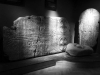
Finally I have been to the visitor centre at Glendalough and very good it is too. The audio-visual presentation is a bit 'wishy-washy' and tells you very little about Glendalough itself, concentrating more on monastic life in Ireland.
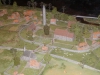
Despite this quite disappointing start the rest of the displays are very informative and enjoyable. There is a nice model of what the settlement may have looked like in its prime as well as some good information boards.
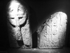
Located inside you will find the Market Cross, featuring a crucifixion and bishop carved in high relief and some lovely Celtic knotwork. Also the nicer cross slabs have been moved inside too for protection.
Another mystery was also solved. I had heard that there were two bullaun stones next to St. Kevin's Chapel (County Wicklow), but could only ever locate one of them. The other has been moved inside the visitor centre and has a turn stone within it.


Sunday, 3rd May 2009
I'm not going to make an entry against each monument I took my mum to today. The pleasure of walking and talking to my mum was the reason for this visit. With her living in Spain I don't see enough of her and today's walk was a real pleasure.
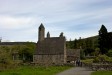
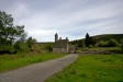
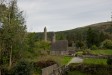
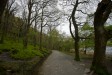
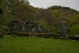
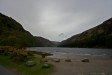
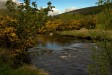
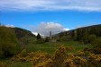
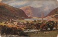
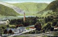
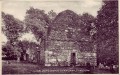
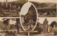
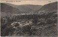
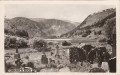
I will use the trip as an excuse to post a variety of images from around Glendalough, though, some of which don't contain monuments. It's a great place and the valley itself is a monument in its own right.
Click Thumbnail to View Full Size Image
____________
Like this monument
Marked Sites
Old Images
Click Thumbnail to View Full Size Image
 _
_ _
_ _
_ _
_ _
_ _
_ _
_ _
_Random Gazetteer
A Selection of Other Visitor Centres
About Coordinates Displayed
|
This is an explanation of (and a bit of a disclaimer for) the coordinates I provide. Where a GPS figure is given this is the master for all other coordinates. According to my Garmin these are quite accurate. Where there is no GPS figure the 6 figure grid reference is master for the others. This may not be very accurate as it could have come from the OS maps and could have been read by eye. Consequently, all other cordinates are going to have inaccuracies. The calculation of Longitude and Latitude uses an algorithm that is not 100% accurate. The long/lat figures are used as a basis for calculating the UTM & ITM coordinates. Consequently, UTM & ITM coordinates are slightly out. UTM is a global coordinate system - Universal Transverse Mercator - that is at the core of the GPS system. ITM is the new coordinate system - Irish Transverse Mercator - that is more accurate and more GPS friendly than the Irish Grid Reference system. This will be used on the next generation of Irish OS maps. |


Page loaded from cache: (Generation time: January 17 2020 21:37:29.)